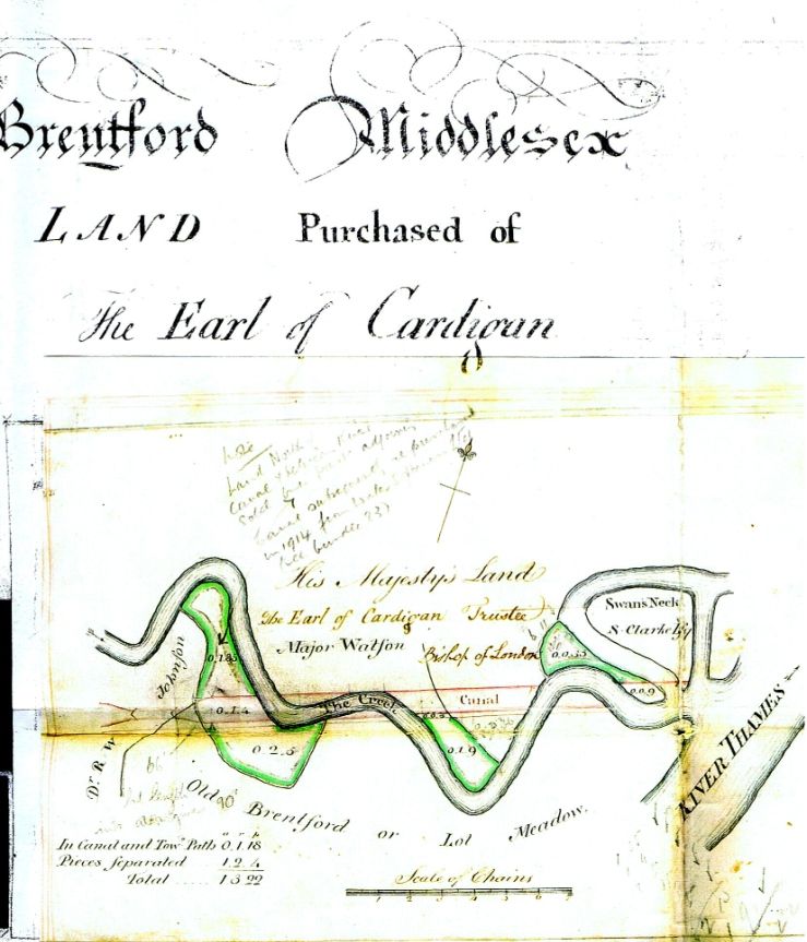
West of Dock Road was the copyhold of Dr Johnson, to the East belonged to George III as an osier bed. The canal company had to purchase land surplus to requirement under their Act, and arranged to sell back that surplus [both Johnsonís and GIIIís] to Johnson at a presumably marked down price Ė so Johnson ended up with GIIIís bit as well, no doubt at a nice profit!
Strictly speaking then, both west and east of MSOís operation could be called ĎJohnsonís Islandí
Tearing my hair out with photobucketís new codes, trying to figure how they translate for this site, but if it works, this is the relevant conveyance [Earl of Cardigan acting as Trustee for GIII] Ė
